How do you use geodata to better value real estate?
The desire
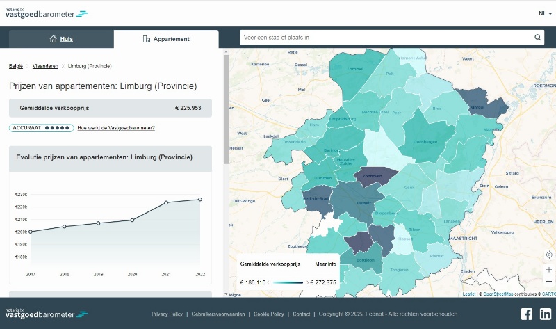
Info on what to go to a notary public for? For that, there is notary federation Fednot. Fednot also supports the notary offices themselves. They don’t just do that with legal advice. They also help the offices work more efficiently, for example with joint IT solutions. Fednot wanted to give its notaries a better tool to stick the right price on real estate. A tool that takes geodata into account. Geo Solutions figured out which geodata and geo solutions were useful. We also looked at how to implement them technically. Thus, we further improved the existing Notary Real Estate Barometer.
Geo Solutions in action
The notary public does real estate appraisals and analyzes the real estate market. In doing so, they use a central database of reference data. Intrinsic location data or spatial factors of the property hardly played a role until now. Examples include accessibility to public transportation, schools, shopping … Yet all factors that affect price. Also environmental variables such as flood prone areas, spatial regulations, and socioeconomic parameters. One of the challenges was that this data should be available for the Belgian territory. Not obvious in a country where those data are not managed regionally by the same governments.
During the study, Geo Solutions researched and mapped the various data sources and platforms. We also checked its availability and application to the real estate industry.
Geo Solutions guided us very well in our first steps in geodata. We especially liked the hands-on approach.
Erik Klewais (AI Manager Fednot)

The Value
We provided a manageable set of spatial data. The notary and his or her staff now make even better assessments of properties in their neighborhoods. It enriches the real estate barometer, allowing one to refine on spatial factors as well.


